
Wednesday, November 18, 2020 at the University of Illinois was our virtual celebration of GIS Day, the annual salute to geographic information science and technologies for achieving broad and transformative impacts. We celebrated the diversity of GIS applications and the capability of geospatial technologies to bring synergies in research and education across campus. We also focused on the contribution of our students to geospatial data science, geovisualization, and geospatial technologies. The event included a keynote speech, a networking event, and virtual student poster competition.
Agenda
- 10:00 am: Welcome and Introductions
- Shaowen Wang
Department of Geography and Geographic Information Science
The University of Illinois - Kevin Pitts
Vice Provost for Undergraduate Education
The University of Illinois - Tracy Parish
Director of Corporate and Foundation Relations
The University of Illinois
- Shaowen Wang
- 10:20 am: Keynote - A Geospatial Journey: Putting Data on a Map
- Dr. Martin Mendez-Costabel
Geospatial Data Asset Team Lead
Bayer Crop Science
- Dr. Martin Mendez-Costabel
- 11:15 am: Networking Session with Bayer Crop Science
- 12:00 pm: Student Poster Session (See the breakout room assignments below in the poster gallery)
- 1:00 pm: Awards Presentation
- Student Poster Competition Winners
- Bob Rauber
Director of the School of Earth, Society, and Environment and
Professor of Atmospheric Sciences - Make-a-Thon Winners
STEM Illinois, Nobel Project
Partnering with Carle Illinois College of Medicine - Ruby Mendenhall
Associate Professor of Sociology, African American Studies, Urban and Regional Planning, and Social Work
Assistant Dean for Diversity and Democratization of Health Innovation, Carle Illinois College of Medicine - Lisa Goodpaster
Associate Director of Project Management
Carle Illinois College of Medicine - Molly Galloway
Doctoral Student
Education Policy and Organizational Leadership
Keynote Speaker
Dr. Martin Mendez-Costabel holds an agronomy degree (BSc) from the National University of Uruguay, and two Viticulture degrees, one from The University of California at Davis (MSc) and the other from The University of Adelaide in Australia (PhD). He has worked for over a decade in the agricultural sector covering a wide range of precision agriculture-related roles, including data scientist and GIS Manager for E&J Gallo Winery in California. Dr. Mendez-Costabel currently leads the geospatial data asset team at Bayer’s Products and Engineering organization within the IT department, where he drives the engineering and adoption of global geospatial data assets for the enterprise.
Student Poster Competition Gallery
The 2020 virtual Illinois GIS Day included a virtual student poster session and competition. The principal authors of all submissions were University of Illinois undergraduate or graduate students, although some posters were created in partnership with faculty advisors or collaborators. This event was conducted entirely online.
Awards were presented at the 1 pm awards ceremony, and included one first prize of $300, two second prizes of $200, and three third prizes of $100.
Click the thumbnails below to view the full-size poster PDF files.
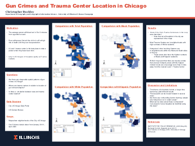
Gun Crimes and Trauma Center Location in Chicago
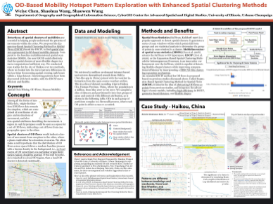
OD-Based Mobility Hotspot Pattern Exploration with Enhanced Spatial Clustering Methods
Breakout Room #5
Third Place Winner
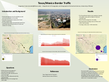
Texas/Mexico Border Traffic
Breakout Room #4
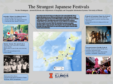
The Strangest Japanese Festivals
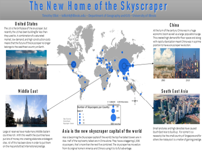
The New Home of the Skyscraper
Breakout Room #1
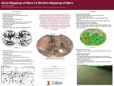
Early Mapping of Mars vs Modern Mapping of Mars
Breakout Room #1
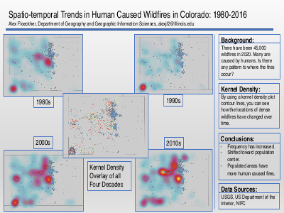
Spatio-temporal Trends in Human Caused Wildfires in Colorado: 1980-2016
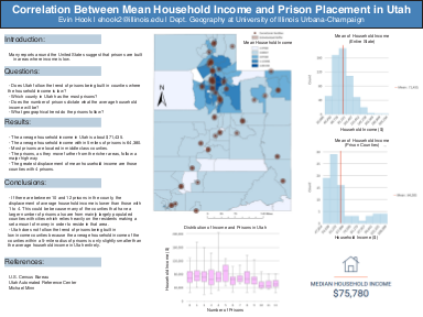
Correlation Between Mean Household Income and Prison Placement in Utah
Breakout Room #4
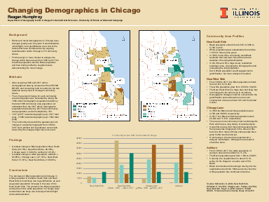
Changing Demographics in Chicago
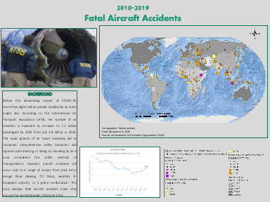
Fatal Aircraft Accidents: 2010-2019
Breakout Room #2
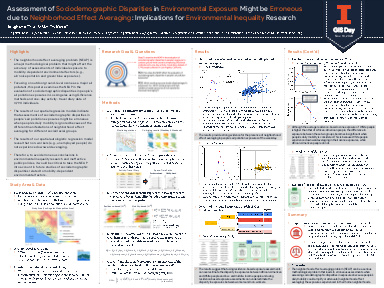
Assessment of Sociodemographic Disparities in Environmental Exposure Might be Erroneous due to Neighborhood Effect Averaging: Implications for Environmental Inequality Research
Breakout Room #2
First Place Winner
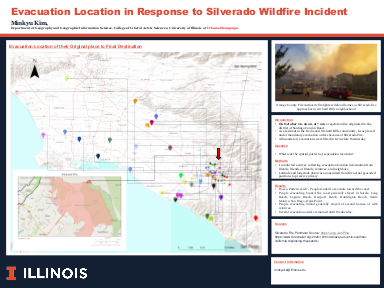
Evacuation Location in Response to Silverado Wildfire Incident
Breakout Room #4
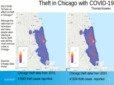
Theft in Chicago with COVID-19
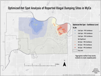
Optimized Hot Spot Analysis of Reported Illegal Dumping Sites in WyCo
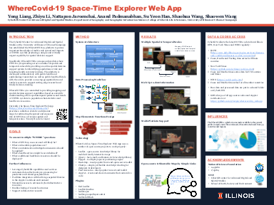
WhereCovid-19 Space-Time Explorer Web App
Breakout Room #4
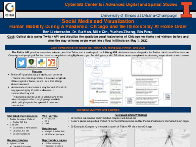
Social Media and Visualization: Human Mobility During A Pandemic: Chicago and the Illinois Stay At Home Order
Breakout Room #4
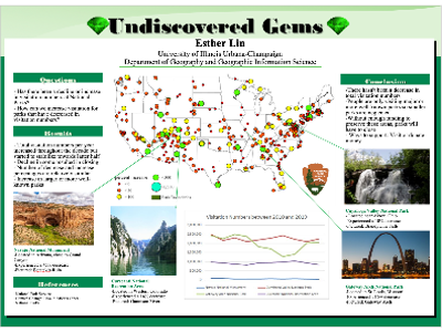
Undiscovered Gems
Breakout Room #2
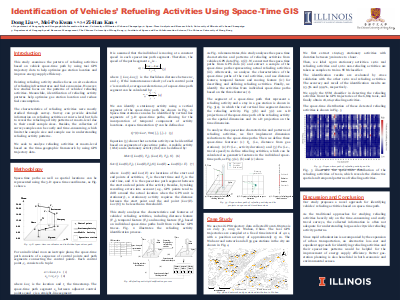
Identification of Vehicles' Refueling Activities Using Space-Time GIS
Breakout Room #5
Second Place Winner
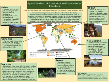
Spatial Analysis of Ecotourism and Economies of Countries
Breakout Room #1
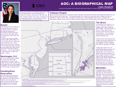
AOC: A Biographical Map
An Exploration of the Effect of Buyer Preference and Market Composition on the Rent Gradient using the ALMA Framework
Breakout Room #5
Third Place Winner
Exact Statistical Method for Analyzing Co-location on a Street Network and Its Computational Implementation
Breakout Room #5
Second Place Winner
Analyzing Global North vs. Global South: Does GDP Usually Predetermine a Country's Ability to Commercialize Fishing?
Breakout Room #2
How Location Correlates to Homicide in the City of Chicago

Understanding the Conflict in Nagorno-Karabakh
Breakout Room #1
The Spatial Distribution of Confederate Symbols and Race in Louisiana
Third Place Winner
Geospatial Fellows combat COVID-19 with CyberGISX
Distribution of Commercial Network Resource of the United States
Breakout Room #5
Farmland's Effect on Local Water Quality
Breakout Room #2
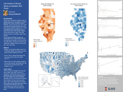
Low Access to Grocery Stores as Diabetes Risk Factor
Breakout Room #4
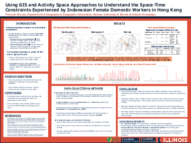
Using GIS and Activity Space Approaches to Understand the Space-Time Constraints Experienced by Indonesian Female Domestic Workers in Hong Kong
Breakout Room #1
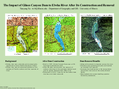
The Impact of Glines Canyon Dam to Elwha River After Its Construction and Removal
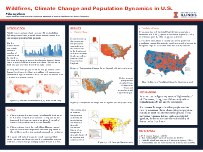
Wildfires, Climate Change and Population Dynamics in U.S.
Industry Sponsor
![]()